|
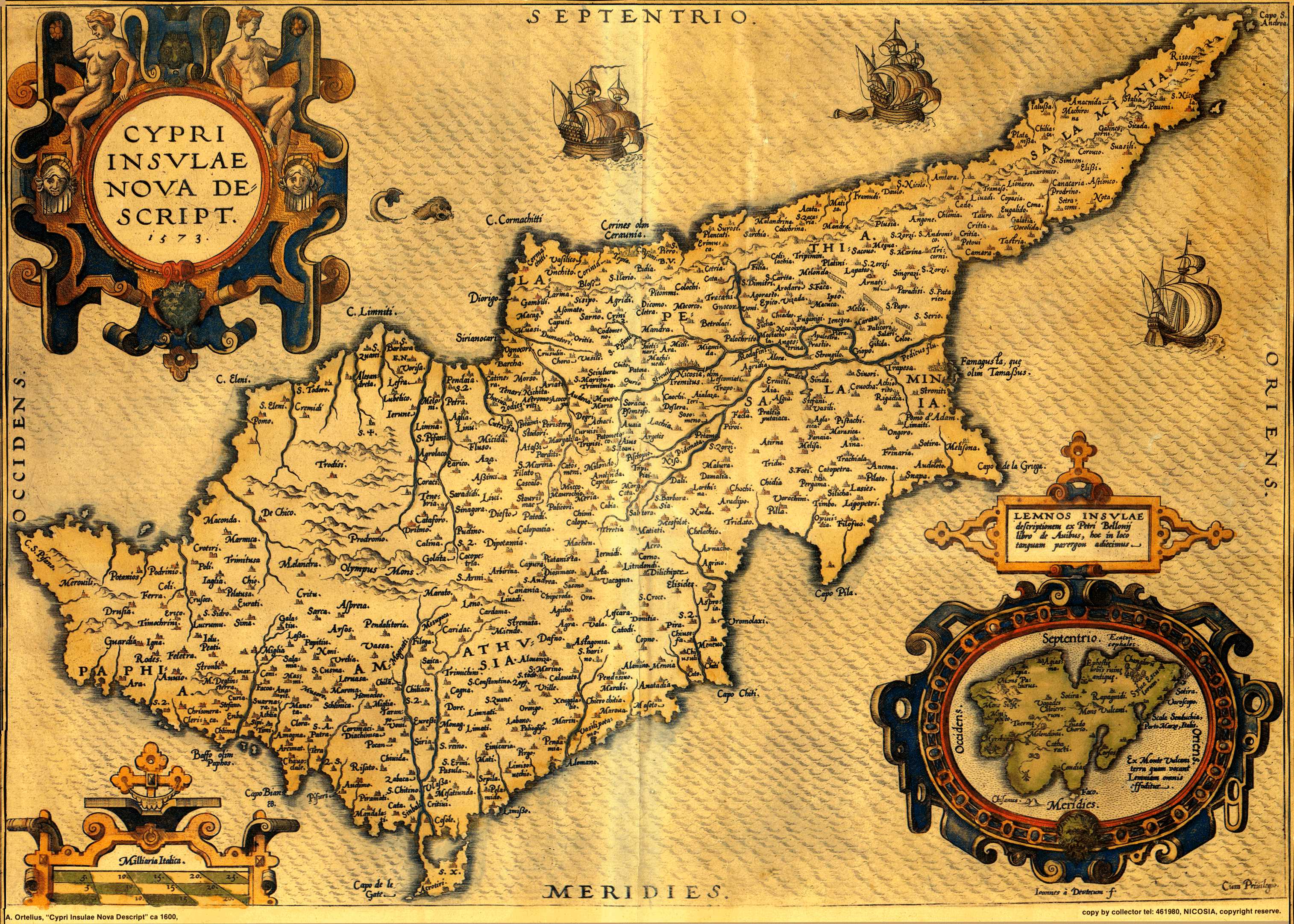
Abraham ORTELIUS (publisher) , Ioannes a DEUTECUM (engraver) , "Cypri Insulae Nova Descript . 1573 ." (350x495mm) page 52 , Theatrum Orbis Terrarum , Antwerp 1600 . Latin . Coloured . |
|
The first edition of Ortelius' Theatrum (Antwerp 1570) included an old-type map of the island (see Fig.88). In 1573 , in Additamentum I , Ortelius introduced a new map of Cyprus coupled with Lemnos inside a cartouche . His prototype was an extremely rare map of Cyprus by Jacomo Franco published in Venice in 1570 . Franco's map offered the latest correct data concerning Cyprus at that troubled period . Strangely , Franco did not make further use of his map . Thus , Ortelius' map of 1573 became the most advanced and correct prototype , destined to be used by cartographers and publishers throughout Europe until the middle of the 18th. century . The text at the back was periodically up-dated by Ortelius while his engravers conditioned the printing plate since the map was published in all the subsequent editions of the Theatrum in various languages . This map here is a 1600 copy . |
|
|
Read the Latin text at the back of the plate . |
|
![]()
|
|
|